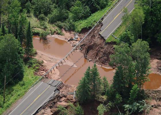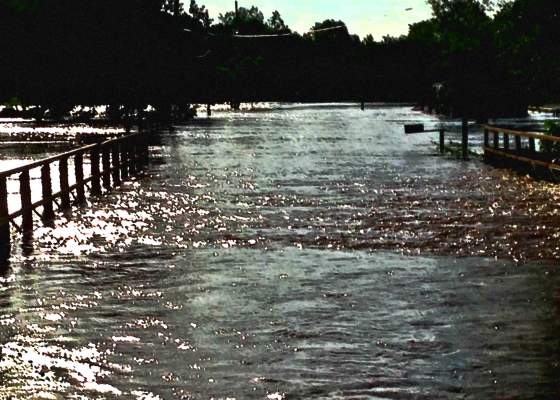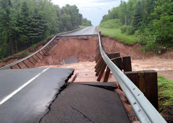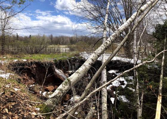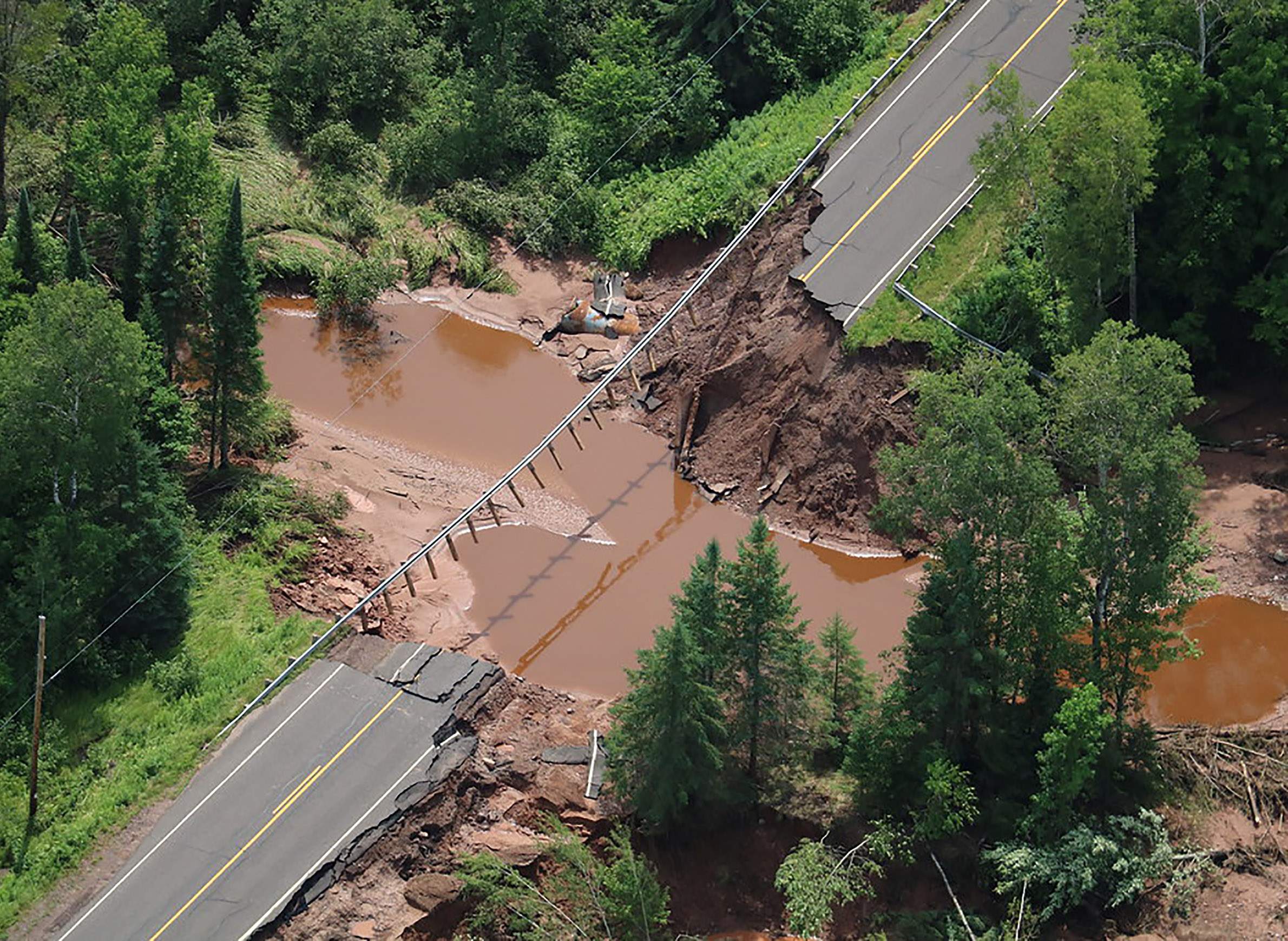
The July 2016 flooding in northwest Wisconsin destroyed roads, bridges and culverts across the region, including this stretch of State Hwy. 169 at the Potato River in Iron County.

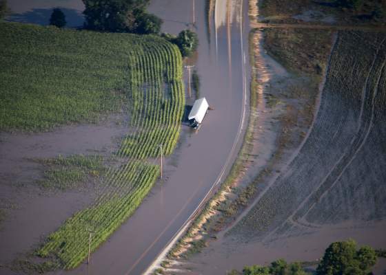
The number of severe storms in northwest Wisconsin is growing. They're also getting more intense, dumping an increasing amount of rain on the region. That's causing problems for a lot of the region's local communities. They are trying to rebuild their damaged infrastructure to deal with more rain, but they are also working within the limitations of their budgets.
One of the first environmental scientists in northwest Wisconsin to raise concerns about how prepared the region was for more intense flooding is Randy Lehr. He's a former environmental scientist at Northland College in Ashland, and is now the dean of math and science at Sierra College in California. He has written op-eds for the Milwaukee Journal Sentinel and Ashland Daily Press, in 2016 and 2018, respectively, about being ready for more intense and more frequent storms.
Lehr spoke about these issues in an Aug. 15, 2019 interview with Wisconsin Public Radio's Central Time. The complete audio of this discussion (which also included WisContext associate editor Will Cushman) follows, along with an abridged version of the conversation.
Rob Ferrett: Back in 2014, you said Chequamegon Bay was arguably, and I'm quoting here, the least climate adapted spot in the country from an infrastructure standpoint. What did you mean by that?
Randy Lehr: When I made that comment, we were looking at some of these historical rainfalls. The National Weather Service for a long time had produced a data set that gave information to engineers to get a sense of how big they should build culverts and bridges at different road crossings every time a road crosses a stream.
They want to know how much rain falls on the land upstream so they can get a sense of how big the culvert needs to be, or how big the bridge needs to be. It turned out that the data they were using back in the 1960s wasn't matching up with some of the things that they were seeing on the ground.
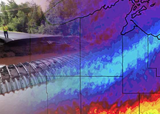
So, the National Oceanic and Atmospheric Administration started to update these data. And when they did, they found out that there were some places where the new estimates were wildly different than the old numbers that were out there. And one of those places was Chequamegon Bay.
The new numbers were saying that it was raining somewhere between maybe 20 to 45% more now than it used to.
Engineers had been designing and building road crossings with these old data for a really long time, and it turns out that after we looked at things a little more found they were undersized and so prone to this kind of washout.
You raised a couple of what-ifs. There is a proposed big iron mine in the region and more recently a proposed large-scale animal farm in the region. Those weren't there for the flooding. What kind of worries would you have for projects like those if they were there.
I think that was one of the big what-if questions that we were wrestling with. These large scale development projects are guided in how they have to deal with rainfall and stormwater by different parts of the administrative code, and the administrative code in Wisconsin really hasn't been thoroughly updated to reflect our new understanding of rainfall intensity. Had those two large-scale developments been built, they would have been required by law to use data that were already outdated to design manure storage or mine tailings waste ponds to treat water quality or to improve water quality.
It's a big what-if scenario, but the question that presents itself is had these facilities been built with outdated standards, and we would have gotten these big rainstorms on top of them, what would have happened? Would the facilities have held or would the manure ponds and mine tailings ponds have washed out just like we saw much of the other undersized infrastructure wash out?
Has this series of storms been a wakeup call? Does this have people actually trying to fix this thing before the next big storm?
Definitely. I think the local governments are really keyed in on this and doing what they can to update facilities and try to prepare and prevent the impacts of other such storms into the future. But there are some limitations in the way that FEMA funds can be used to replace a washed out road crossings. You know most of these communities are in very rural areas and so they just don't have a lot of funding to go in and preemptively upgrade or increase the size of road crossings.
One of the areas that things have lagged behind a little bit that I alluded to is we really haven't updated our administrative code throughout the state. Other other states throughout the region, Minnesota for example, took these new rainfall estimates and seven, eight years ago now updated the requirements for engineering design and construction projects to incorporate our new understanding or updated understanding of rainfall. And Wisconsin just hasn't done that in a thorough way at this point in time. So we're a little bit behind the curve there, I would say.
Are there more or less universal lessons that local governments, local committees can take to say, yeah we want to be more flood-resilient given this changing storm landscape?
Yeah, I think there's two different ways to approach that.
Say a small culvert washed out and you wanted to replace it with a larger culvert. If you do the design work ahead of time and you know based on some scientific assessment that, yep, the culvert that's in there right now is too small, when we replace it we should replace it with a larger one. If those types of studies have been done ahead of time, FEMA has a mitigation process where they allow you to put in a larger culvert. But doing that sort of in the heat of the moment after you've had a large-scale disaster in a county is really difficult. And so the more that that type of planning can be done on the front end, the easier it is to use some of these federal dollars to upgrade infrastructure.
The other thing that the region is doing quite a lot of is on-the-ground projects to try to slow the flow of water across the landscape.
That's doing things like putting in rain gardens or constructed wetlands or things like that to trap more of the runoff or slow it down before it gets into the stream. So if there's less water that gets into a stream after a big rainstorm, then the size of the infrastructure you need to build can be proportionately less. There's a lot of attention being paid to that on the south shore of Lake Superior right now.
Are we counting on this county government and this small city in this township and this village to each come up with their own solutions, or do we need more coordinated efforts at the state level or federal level?
I think it's going to take cooperation across all levels. I think most of this is being driven by the local-level governments right now. They're the ones that are having to deal with this most intimately. But we're starting to see some traction at both the state and federal level. But I think really to get the ball across the goal line, it's going to take a large-scale cooperative effort.
What do you see when it comes to climate change and our risk of flooding?
You know you can't really ever attribute one storm to climate change — it's more the more the trend, the trajectory. But one of the interesting and maybe disturbing things about the region is that, in most cases in northern Wisconsin over the last 50 years, the state had actually been in pretty significant drought with the exception of the Chequamegon Bay area. The amount and the intensity of precipitation had actually been increasing over the last 50-plus years, while the rest of northern Wisconsin was actually drier and drier.
There's a lot of questions about will that continue to increase into the future and, sort of, our region-wide study suggests that it will. The degree to which that happens and the timing over which that happens is a little unclear. But the trends seem like they're all lining up.
And the fear is that we're going to see more extremes, so we might see unusually long droughts and then unusually intense rainfalls — we could see them going back and forth.
Exactly. That's the concern is that you'd have intermittent periods of drought and flooding. Neither one of them is particularly good.